Menu
-
- Fittings
- Annexes
- Comfort
-
Electricity
- LED bulbs
- LED bulbs
-
- Batteries
- See all products
-
- Battery chargers
- Battery chargers
-
- Controllers of batteries
- Controllers of batteries
-
- Converters
- Converters
- Disjoncteurs thermiques
- Disjoncteurs thermiques
-
- Lighting
- See all products
-
- Wind turbines
- See all products
-
- Navigation lights
- Navigation lights
-
- Generators
- Generators
-
Electronics
- Accessoires ADVANSEA
- Accessoires ADVANSEA
-
- Audio marine
- Radio packs
-
- Cameras
- See all products
-
- GPS handsets
- GPS handsets
-
- Multifunction displays
- Loch speedo
- GPS marine
- Portable GPS
-
- Instrumentation
- Combined 7 inch
-
- Internet at dock
- See all products
-
- Autopilots
- See all products
-
- Weather receivers
-
Maintenance
- Antifouling
- See all products
-
- Bilge and engine
- See all products
-
- Comfort on board
- Comfort on board
-
- Hull and deck
- See all products
- Mastics et Colles
- Mastics et Colles
- Defenses and pneumatic
- See all products
-
- Greases and lubricants
- Greases and lubricants
-
-
- Stainless steel and metals
- See all products
-
- Tooling
- Tooling
-
Engine
- Anodes
- Anodes
-
- Control boxes
- See all products
-
- Bougies NGK
-
- Câbles de commande
- See all products
-
- Câbles de direction
- See all products
- Coupe circuits
- See all products
-
- Starters and alternators
-
- Hydraulic directions
- Huile Moteur
-
- Filtration
- Filtration
-
- Flaps
- Flaps
-
- Propellers
- Propellers
- Navigation
- Security
-
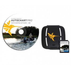
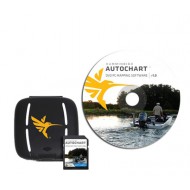
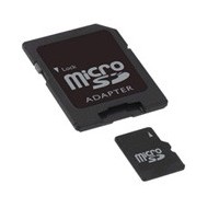
This related to the "Zero Line" card delivered software with, allows, from registrations to trace on the water, to create its own bathymetry and the mapping of the seabed.
This very rich in detail mapping can then be operated on your Humminbird and improved gradually and to measure outputs.
The data are private but can be shared with people using a combined Humminbird having acquired the "Zéro Line" card.
This version of the Autochart software allows in addition to getting a visualization of the hardness of the Fund and an overlay of the image Side Imaging.
Strong points:
- Creation of its own mapping
- Bathymetric lines
- Hardness of the bottom
- Layered image Side Imaging

.jpg)
.jpg)
.jpg)
.jpg)
.jpg)


.jpg)

