 Maximize

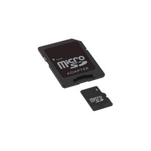
Garmin BlueChart g2 Vision electronic sea chart.
Choose the area of your choice by clicking on the "Download" tab then please see top of page Option region Code, and select the corresponding code.
Be careful, if the code you have chosen does not appear in the list, it means that it is not compatible with the card. If you want an area that is not listed, feel free to contact us.
Do you offer a new perspective for your marine escapades with BlueChart® g2 Vision®. BlueChart g2 Vision data offer a marine detailed mapping, with useful nautical information and other high-end features. With BlueChart g2 Vision, the position of your boat is indicated accurately on the map, and the distance that separates you AIDS to navigation, coastal features, areas of anchorage, obstructions, waterways, limited access areas, etc.
Detailed maps You also have access to detailed map features, shading of safety, fishing maps, the smooth transition at the zoom level changes, the harmonious transition between the limits of cards and the decrease of discontinuities of cards. This map display is the most realistic ever offered by Garmin.
Navigate in three dimensions Exclusively on the Garmin marine maps, find the views 3D "Mariner's view" and "Fish eye's view" for a display highlight the close environment of your boat, above and below its water line.
3D display facilitates positioning in space and will return the maximum information for navigation all comforts...
Features of BlueChart g2 Vision BlueChart g2 Vision cards include all the functions of cards BlueChart g2 and the following advanced features:
-Homing technology shows you the best route to follow.
-Fisheries maps: view maps of fisheries detailed with a representation of the bathymetric curves every 2 meters.
-Satellite images high resolution.
-Aerial photos of ports, marine, coastal roads...
-Mariner's Eye View - perspective 3D mapping data.
-Fish Eye View - perspective 3D below the water line to display the seabed from the bathymetric data.
-Graphics of the tides, sense of currents and marine services.
-Detailed tourist information of the coastal routes (up to 5 miles inland) with points of interest NAVTEQ.
BlueChart g2 Vision cards compatibility BlueChart g2 Vision cards are recommended for the GPSMAP 620 series GPSMAP 4000 and 5000 BlueChart g2 Vision cards are also compatible with Colorado, Oregon, nüvi 500 series and the GPSMAP 420, 520, 525.
Caution: this product is programmed on command. All committed orders cannot be repeated or modified.